PARKING ENFORCEMENT PARKING ANALYTICS BRAND MAPPING INFRASTRUCTURE CASE STUDY DATA PROTECTION BERLIN EXPLAINER PATROL APP ANONIMIZER
Parking Analytics
The combination of highly accurate real data acquisition and processing of mass data
Highly accurate.
DCX Innovations PARKINGANALYTICS is based on the combination of highly accurate real data acquisition and processing of mass data at the same time.
In the course of a project, the frequency (acquisition frequency) of a real, piece- and location-specific recording is partially reduced and supplemented by the processing of mass data from external data sources, without causing a significant loss of data quality. Algorithms of "machine learning" are used here.
The acquisition of the real data is based on the use of the Mobile MultiSensor™ system CITYSCANNER®.
Digital, georeferenced recording of parking zones
Digital, georeferenced recording of parking zones
Precise occupancy rates of parking zones
User-specific parking space usage data
Prediction of future utilization rates
Before / After Analytics
….
Digital, georeferenced recording of parking zones
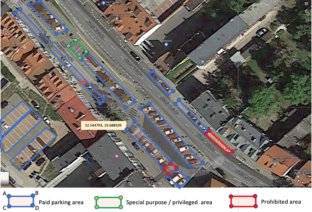
Geometry
of polygons
per each parking zone
(e.g. json format)
Geometry (e.g. json format) of polygones
per each parking zone
Number of parking spaces
Management form:
Fees
Time regulations
Bespoke analytics made to your custom needs
Statistics on utilization

Real data utilization of parking spaces at defined periods
•at a single moment
•per day
•per month
•per year
Prediction of utilization by the combination of real data
with mass data (e.g. floating car data) and machine learning algorithms
User specific data

Parking duration
according to time classes
e.g. 1-3h, 3-10h, 10-24h,> 24h
•Ratio of commuters
•Ratio of residents
•…..
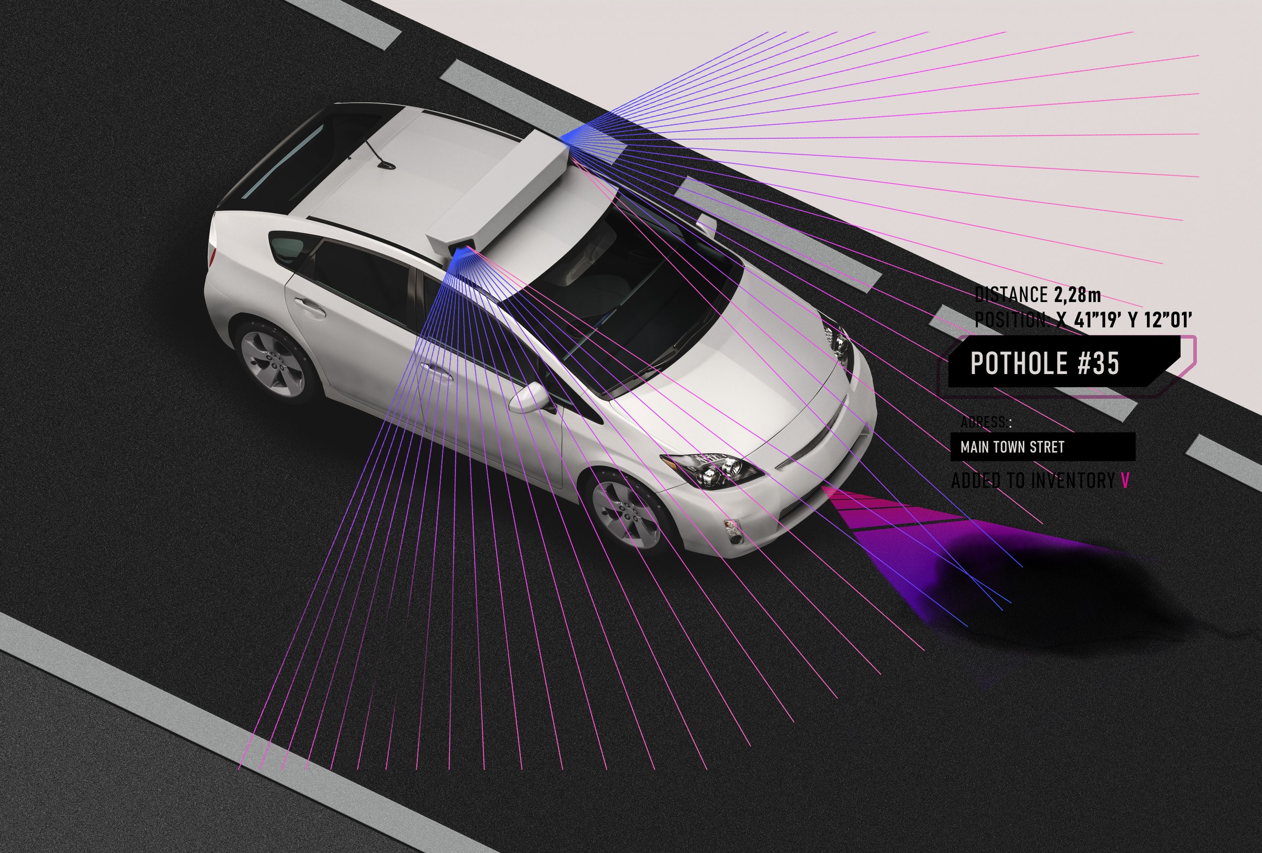
Data capturing on parking violations

Analytics of dangerous parking violations based on the exact location of the parked vehicle
Loading zones
Firefighting zones
Other prohibited areas
Data can be used just for statistics or also for
real time enforcement
On the edge advantage of CITYSCANNER® ensures data safety
-
"On the edge” using computing unit onboard the car

-
To prevent data loss no sensitive data is transferred.

-
How does the onboard anonymization work

-
![]()
Accuracy
Number plate information is augmented with high precision GPS location (up to 5 centimeters at any speed). Up to 99% ANPR accuracy rating.
-
![]()
Connectivity.
Supports several standards protocols to deliver the data to the place of your choice. Ready for custom data integration.
-
![]()
24/7
Operating every time of a day and night, regardless of weather conditions.
-
![]()
Compact.
The system fits into a roof top box and can be mounted on any vehicle.


Safe Data.
Comply with strict new rules around protecting customer data. The General Data Protection Regulation (GDPR) sets a new standard for consumer rights regarding their data


Book an appointment.